Projects
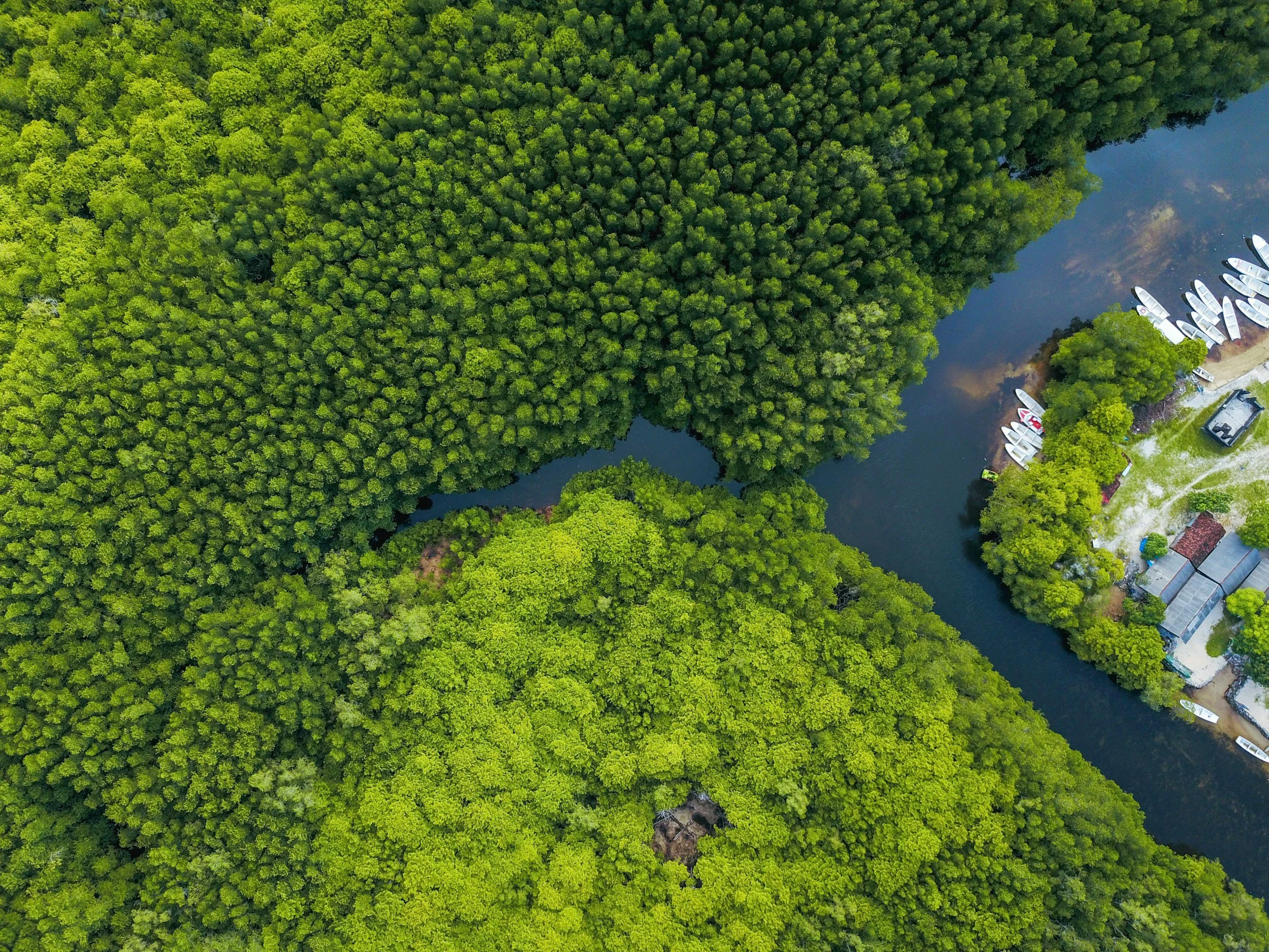
BioREaCH
Biodiversity-Remote sensing for Estuarine and Coastal Habitat research (BioREaCH) is part of the BioSCape field campaign in South Africa. The project will improve our understanding of estuarine biodiversity with a particular focus on coastal wetlands in the Greater Cape Floristic Region using airborne imaging spectroscopy, lidar, satellite imagery, and field data. We are evaluating the drivers of biodiversity across the land-ocean aquatic continuum with state-of-the-art remote sensing and investigating the potential impacts of climate change on coastal biodiversity.


PANGEA
The tropics are experiencing dramatic changes as a result of climate change and land-use change. Shifts in carbon flux dynamics, water cycling, and species composition are resulting in feedbacks with globally important consequences. However, tropical forests are not a monolith. They vary enormously in terms of species diversity, climate, soils, human impact, and much more. As a result, tropical forest ecosystems will almost certainly vary in response to climate change and land-use change. Yet, these differences remain highly uncertain and poorly understood. PANGEA (PAN tropical investigation of bioGeochemistry and Ecological Adaptation) is a NASA decadal Terrestrial Ecology campaign that aims to better understand the combined effects of climate and land-use change in tropical forests within and between continents. If selected, NASA would support a 6-9 year field campaign that will combine in-situ field data with remotely sensed airborne and spaceborne data.
Image Source: https://tropicalforestscoping.com/about/
To learn more about PANGEA: https://tropicalforestscoping.com/
BlueFlux-2
The BlueFlux campaign measured carbon dioxide and methane fluxes over wetland ecosystems in southern Florida using ground-based measurements and eddy covariance (EC) towers paired with novel airborne EC techniques to better understand blue carbon dynamics in light of ongoing sea level rise, hurricanes, and hydrological restoration. Flux predictions made through data-driven upscaling provide daily insights into wetland carbon dioxide and methane fluxes over 20 years at 500-m using MODIS. BlueFlux-2 continues to expand airborne flux measurements and field measurements to include additional spatial and seasonal coverage and improve flux partitioning in south Florida. Upscaling models will be adapted to include lateral aquatic flux components and developed with new remote sensing data from VIIRS and the harmonized Landsat-Sentinel products due to MODIS being decommissioned. BlueFlux prototype predictions of daily flux predictions will aid operational and decision-making frameworks and help constrain emissions factors used for blue carbon ecosystems in greenhouse gas inventories.
Image Source: Pilot Lawrence Grippo
To learn more about BlueFlux-2: https://earth.gsfc.nasa.gov/acd/campaigns/nasa-carbon-monitoring-system-blueflux

Earth Observation-based restoration and monitoring in Coastal and Forested Protected Areas of West Africa
The goal of this project is to develop pathways to incorporate operational use of EO based information for conservation and restoration projects in West African PA’s. This will help access C finance and effectively implement climate change mitigation and adaptation through the restoration, conservation and sustainable use of mangroves and forests at local, national and regional scale. This project will contribute to ensure the long-term effectiveness of conservation of forests and coastal ecosystems, using NASA data.
